Simcenter Flomaster provides multiple options for importing your system’s geometry into the tool. Some of the benefits of working in this way include reduced model-construction time, less manual work, and the ability to reuse already created CAD geometry.
Apart from importing geometrical data describing a system’s different parts, such as pipes, junctions, and volumes, an intriguing concept is to also account for variations in height or length caused by the topography of the ground which the facility is placed on.
Geographic Information Systems (GIS) import capability opens for the possibility to explore multiple sites for a facility, or to determine how the same system would operate if placed in different locations around the world. Allowing for studies to be made where system performance is evaluated against different possible piping routes. For example, for a district heating system (Topography), or across the seabed for a pipeline system (Bathymetry).
In this article we explore how to create and import a GIS pipeline to include the topographical dependency to the system.
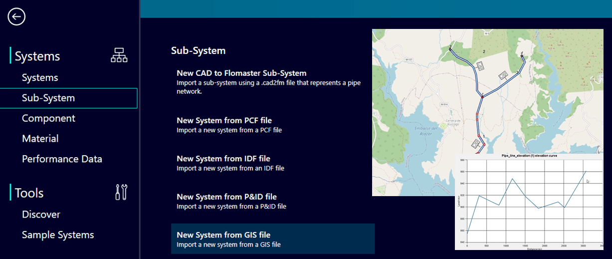
Starting from the landing page in Simcenter Flomaster, GIS files can be opened and read into the tool by navigating to “New System from GIS file” under the Sub-System tab.
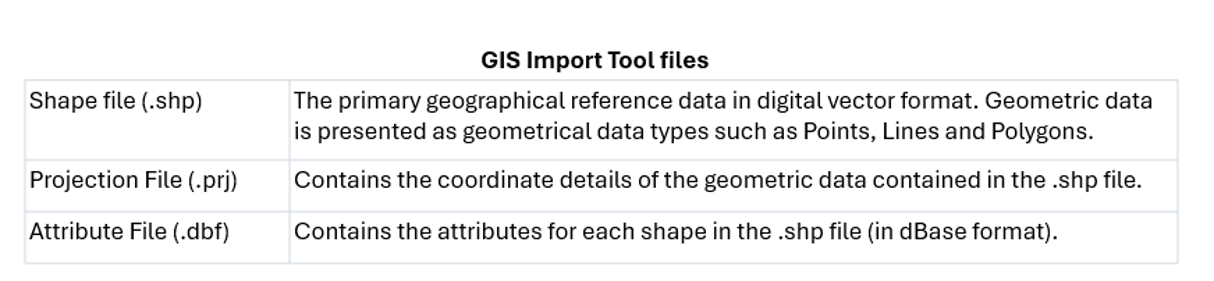
The import routine requires that a few files have been created in advance, in addition to that any predefined parameters present in the GIS data are mapped to Simcenter Flomaster, e.g. diameters, friction factors. Throughout this article we will show an example how these files can be created by building a simple pipeline system using the open-source tool QGIS.
The version of QGIS used throughout this excelsis is v3.34.15 (Long Term). Note, if you decide to use a different or later version of QGIS when trying to replicate the steps taken here you may run into that some of the plugins may not be compatible with your version, or that development was only continued to a certain point (version). The cons of open source.
In the video-guide below the necessary steps to create and import a subsea pipeline system are shown using bathymetry (seabed topography) from opentopography.org. In order to access these maps, and use the plugin “DEM Downloader”, registration at their site is mandatory to receive the API key the plugin uses.
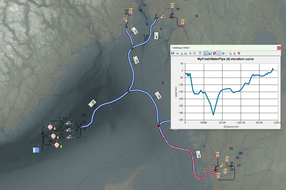
Once imported, these types of pipeline systems can be connected to pumping stations and modified to include any manner of bypass valves or filters. Working with accurate elevation data provides better predictions for the total required head in the system, in addition to improving simulations where cavitation is of interest due to power outages.
We hope you have found this article interesting. If you have any questions or comments, please feel free to reach out to us at support@volupe.com.
As a final note, special thanks to Adrián Aguilar Villamor (Siemens) for first brining this interesting topic to my attention, and for assisting me during my journey into the unfamiliar realm of GIS.
Author
Fabian Hasselby, M.sc.